
Rifugio Cibrario is located at an altitude of 2600 meters, in a pleasant hollow cut through by several Rio Peraciaval streams that allow a lush and colorful flora. The stillness of the surrounding glacial moraines has favored, in the past few years, the settlement of a great herd of ibexes. Almost daily, they descend to graze near the Rifugio.
Rifugio Cibrario - Vallone Arnas


Indications
Suggested period
July – mid September, the Rifugio opening season.
Starting point
Usseglio – Alpe Barnàs
Elevation gain
1070 m
Travel time
3 ½ hrs
Recommended for
- Mountaineers
- Hikers
- Skilled hikers
Access
Just after the Usseglio central residential area, having overtaken Villaretto hamlet and just before the restaurant hotel “La Furnasa”, turn right and climb the steep road going through the Vallone d’Arnas floor. Keep going, overtake the S. Anna little church, until reaching Alpe Barnàs, starting point of the trail.
Itinerary
From Alpe Barnàs descend towards Rio Peraciaval, cross the wooden bridge and climb the slope. Turn left so as to cross the creek descending from Monte Lera. At an altitude of approximately 1800 meters, the trail reaches the “Decauville” (that is the ruins of the narrow-gauge railroad joining Malciaussia to the Lago Dietro la Torre used to transport the building materials for the Lago della Rossa dam). Follow the railroad track to the right for a few hundred meters, leave them and start a steep climb on the left ending near a waterfall from Rio della Lera. At this point the trail rejoins the one arriving from Margone. After a short stretch of swiftly climbing, the trail, bypassing the “prigioni della Lera” (Lera jails), climbs more consistently until reaching the beautiful Rio Peraciaval waterfall (visible from the bottom of the valley). A daring bridge allows the easy crossing of the stream, after which the trail makes a wide hairpin turn and becomes steeper, always keeping its left orographic side. Through a sequence of hairpin turns you will overtake a ledge, reaching the above Piano del Sabiunin where Rifugio Cibrario stands. You will finally enjoy a beautiful view of the mountain hut.
Bibliography
“70 rifugi del CAI Piemonte” Ed. Susa Libri
Cartography
Alte Valli di Lanzo – carta n° 17 L’Escursionista & Monti editori; Valli di Lanzo – carta dei sentieri 2 Val di Viù e Val d’Ala, IGC 1:50000 N°2 Valli di Lanzo e Moncenisio, IGC 1:25000 N°103 Alte Valli di Lanzo

Nei e Soleil
L'albergo Nei Soleil, direttamente sulle piste da sci, è il posto ideale per il relax e lo svago sia...
Read more 
Albergo Ristorante Bar Grand’Usseglio
The historic Albergo Grand’Usseglio was built somewhere around 1910 by Cibrario Ruscat Domenico, cal...
Read more 
Albergo Rocciamelone
The hotel Rocciamelone is situated in the center of Usseglio village and it was built in 1925. Even...
Read more 
Rifugio Escursionistico Posto Tappa GTA Les Montagnards
You will be received in an independent villa of the early 1900, renovated so as to offer all comfort...
Read more 
Agriturismo La Masinà
Agriturismo La Masinà is located at the begging of Pian della Mussa, well-known place due to its env...
Read more 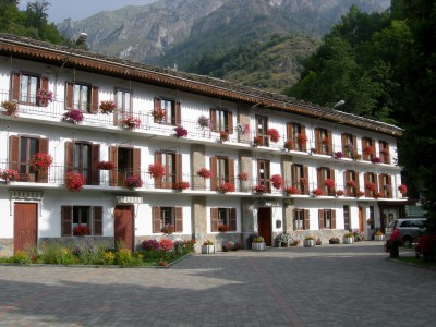
Albergo ristorante Furnasa
Customers are accommodated in a family atmosphere new structure surrounded by the green of Usseglio ...
Read more 
Alpine guides Valli di Lanzo
Our association, whose members are all professional alpine guides, serve a history and traditions ri...
Read more C.A.I. Lanzo
Association with over 1.000 members which organize courses, hiking trips, ski mountaineering, mounta...
Read more 
A.S.D. Sci Fondo Usseglio
The Association manages, for six persons runs and maintains machinery and sport equipment for cross-...
Read more 


