
Due to the ground morphology, this GTA stage offers a climb along gentle slopes of a valley rich in water and small lakes, while the descent toward Usseglio is steep and demanding, requiring particular attention in case of fog or rainy weather. At the beginning of the summer, the rhododendrons blooming offers striking contrasts, while in August, the climb to Passo Paschiet is ideal for the blueberry harvest.
GTA: Balme - Usseglio


Indications
Suggested period
From mid June to September, at the beginning of the season, it is possible to find snowfields in the final climb to Passo Paschiet.
Starting point
Balme
Elevation gain
+ 1120 m ; - 1350 m
Difficulty
E
Travel time
7:30 hrs
Trail indication
EPT 214, GTA, 128
Recommended for
- Skilled hikers
Itinerary
Leaving the Posto Tappa, follow the paved road leading to I Frè hamlet. At the hairpin turn below the hamlet, cross the bridge and follow the obvious trail (indication GTA and 214). Reach the Pian Salè pasture huts, passing by the huge sheep rock called “Balena”(whale). Do not take the trail on the right, but keep on climbing and enter the small wood, tackling a steep stretch taking you to the summit of a wall overlooking the stream below. The trail levels up reaching the Garavela pasture huts. Walk on, always on the orographic right side of the stream, until arriving at Alpe Pian Buet. Just a bit further on, at the crossroads, keep the right and climb a slope with many rhododendrons and alders so as to arrive in sight of Lago Verde Inferiore. Skirt it on the right, climb among huge boulders to Lago Verde Superiore. From here, in a short time you will reach the Gandolfo bivvi, on the right of the trail. The climb now easily proceeds on rubble ground up to Passo Paschiet, beyond which you will enjoy a wide panorama.
With a short descent you will arrive at a trail fork, turn right ignoring the (128A) trail which keeps descending towards Alpe d’Ovarda to end at Lemie. (This itinerary is longer but useful and safer in case of physical problems or reduced visibility.) After having turned right at the fork, you start circling the Torre d’Ovarda slopes, at first climbing to Colle di Costa Fiorita, then descending along steep meadows until you arrive at Pian Venaus. Crossing several couloirs, descend until you definitely turn left to enter a steep conifer wood. Keeping on walking you finally arrive on the left orographic side of Rio Venaus, characterized by the great protection wall. Shortly, reach the paved road, turn right and climb for about 1½ kilometers until reaching the Posto Tappa Albergo Furnasa, at the beginning of Vallone d’Arnas.
Bibliography
“GTA – Grande Traversata delle Alpi” di I. Kürschner e D. Haas Ed. Rother.
Cartography
Valli di Lanzo – carta sentieri 3 Val d’Ala e Val Grande; Alte Valli di Lanzo – carta n° 17 L’Escursionista & Monti editori

Antico albergo Camussot
It is a centuries-old mountain hotel between Piedmont and Savoy where celebrities such as the poet G...
Read more 
Albergo Ristorante Bar Grand’Usseglio
The historic Albergo Grand’Usseglio was built somewhere around 1910 by Cibrario Ruscat Domenico, cal...
Read more 
Albergo Rocciamelone
The hotel Rocciamelone is situated in the center of Usseglio village and it was built in 1925. Even...
Read more 
Rifugio Escursionistico Posto Tappa GTA Les Montagnards
You will be received in an independent villa of the early 1900, renovated so as to offer all comfort...
Read more 
Agriturismo La Masinà
Agriturismo La Masinà is located at the begging of Pian della Mussa, well-known place due to its env...
Read more 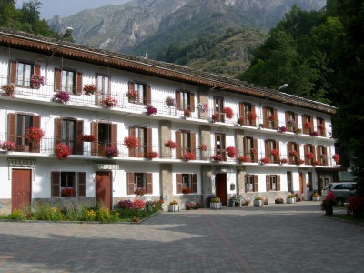
Albergo ristorante Furnasa
Customers are accommodated in a family atmosphere new structure surrounded by the green of Usseglio ...
Read more C.A.I. Lanzo
Association with over 1.000 members which organize courses, hiking trips, ski mountaineering, mounta...
Read more 
C.A.I. Ala di Stura
The Club Alpino Italiano - Ala di Stura branch main purpose is to facilitate people’s approach to th...
Read more 


